
Rosenberg ZIP Postal Coverage
The City of Rosenberg identifies two ZIP codes within its jurisdiction: 77471 and 77469. That is the limited official claim the city makes. Its addressing material does not publish a neighborhood-by-neighborhood postal map, a station list, or a complete USPS boundary polygon. The two rows below therefore describe the city-source relationship, not a promise that every address using either ZIP sits inside incorporated Rosenberg. Start with the address-level postal result, then check the current municipal layers before assigning a City record to a parcel.
| ZIP | City-identified postal area | Post-office detail | Boundary caution |
|---|---|---|---|
| 77471 | Rosenberg postal city/area | No station name is stated in the City source | Within Rosenberg jurisdiction, but a mailing label alone does not prove city limits |
| 77469 | Rosenberg postal city/area | No station name is stated in the City source | Within Rosenberg jurisdiction; an individual address still needs parcel and map confirmation |
The City addressing guidance is the starting authority for those two local ZIP rows. It also says that USPS, rather than the City, assigns ZIP codes. That distinction matters when a Rosenberg mailing city appears on a parcel that county mapping places outside the incorporated line.
Rosenberg’s Addressing page shows the local source behind the ZIP guidance.
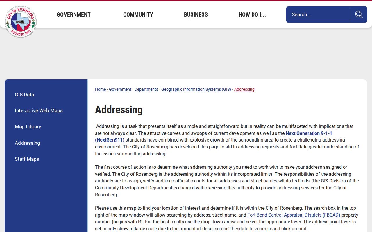
The address rules are useful before any postal-area search because unit type, road name, and street number affect how the same place is matched in postal and property systems.
Rosenberg ZIP Codes and Four Geographies
A Rosenberg ZIP code is one geography among several. Postal city, incorporated city, Fort Bend County jurisdiction, and the City’s extraterritorial jurisdiction can overlap without matching. School, MUD, drainage, precinct, and taxing-unit lines add further layers. A parcel near the line may use a Rosenberg mailing label, appear in county GIS, and be outside the City’s normal permit or code-enforcement scope. Annexation can also change municipal service context without changing the postal ZIP.
The practical test is layered: locate the parcel in the city-limit or ETJ map, see which authority assigned the address, review the FBCAD taxing units, and identify the office that owns the requested record. The Rosenberg Map Room supplies city-limit, ETJ, annexation, subdivision, MUD, and planning context. It is an informational map, not a legal survey or title record.
The Rosenberg Map Room is the official visual source for municipal-boundary context.
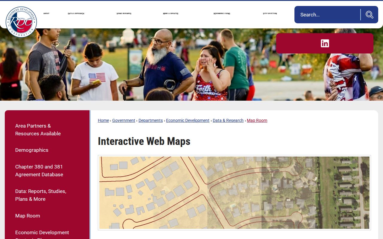
Use the displayed layer name and map date in a research note. A postal lookup result should lead to a mapped parcel, not replace that check.
Rosenberg ZIP Address Normalization
Normalize an address before narrowing research to a postal area. Rosenberg treats the primary address as the street number plus road. Its secondary types include Apartment, Building, Floor, Lot, Suite, Unit, and other standardized forms. Preserve directionals, road-type variants, and the unit. Texas NextGen911 does not use fractional addresses, and a private drive may carry its own name. A missing unit or altered street type can send the same address to a different result list.
Inside incorporated Rosenberg, the City GIS Division assigns and validates addresses. Its map can search an address, street name, or FBCAD property number beginning with R, although address points appear at large scale. In much of the unincorporated area, Fort Bend County Engineering verifies addresses. The City also directs some new-address questions to CenterPoint Maps and Records. These separate routes explain why one address can reach emergency, utility, county, FBCAD, USPS, and City systems at different times.
Rosenberg’s Map Library provides the City’s published map collection, including jurisdiction and planning materials.
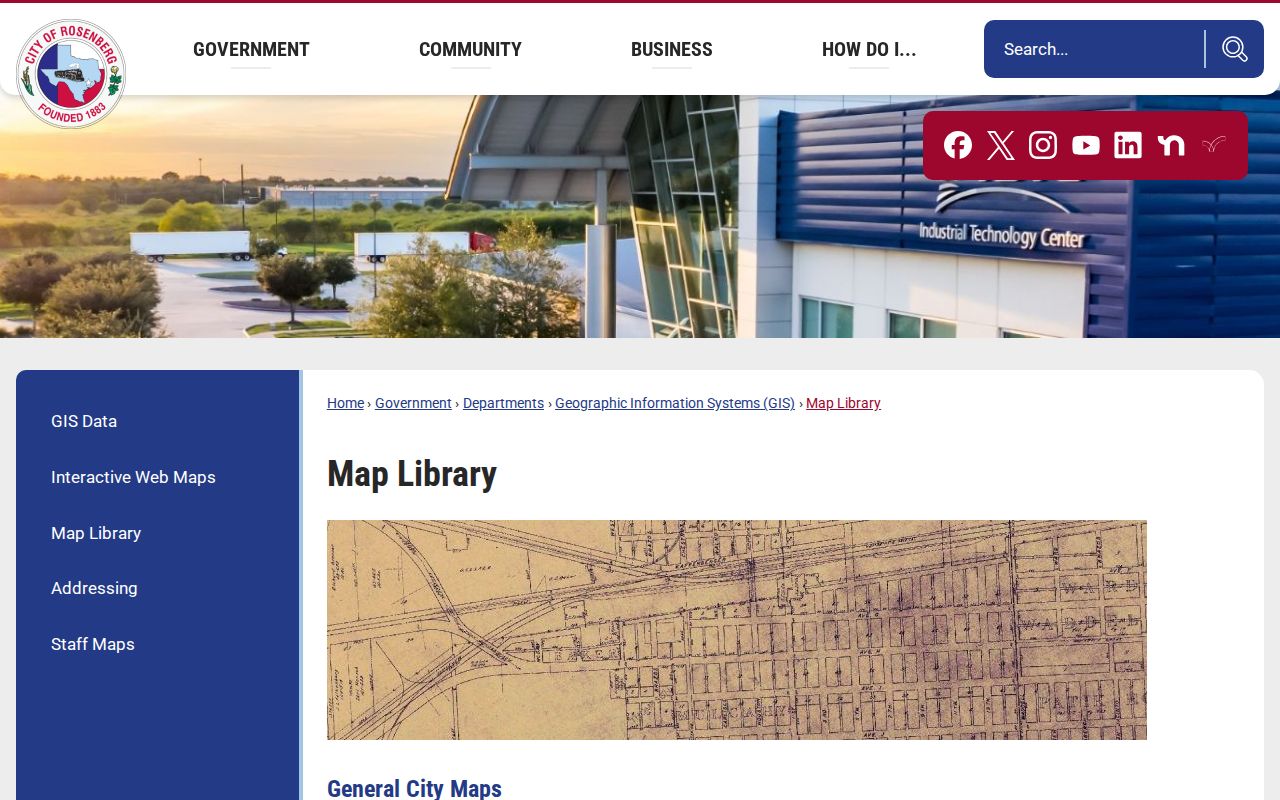
Historic and current maps help preserve an old street form beside a current address instead of silently treating them as identical.
Note: USPS can verify a delivery format, but its result does not confirm that any person or company is at the address.
Rosenberg ZIP Search Fields
No inspected FBCAD screen showed a direct ZIP filter. Its address and advanced controls are still useful once USPS has normalized the street, and its parcel card separates owner mailing and situs fields. The Texas HOA management-certificate system does have a ZIP filter. The SOS voter-list request form offers geography filters, but the captured fields list county and district, not a dedicated ZIP field. Treat that difference as a search limit, not an invitation to infer a household from a postal area.
| Official system | Captured field or filter | ZIP-related use |
|---|---|---|
| FBCAD property search | Street Number, Street Name, Subdivision, Neighborhood, Quick Ref ID, Geographic ID, Tax Year | No ZIP control captured; use a normalized address to locate the parcel |
| Texas HOA certificates | Association type, name, county, city, ZIP | ZIP is a direct filter for association certificates, not a roster |
| SOS voter-list request | County, district, residence or mailing-address options, active/suspense/cancelled status | No ZIP-specific field captured; the regulated file is not a casual ZIP directory |
FBCAD’s property search lets a researcher use By Address, By Owner, By ID, or Advanced. A Quick Ref ID is the fastest route when copied from an appraisal notice or tax bill. The address and owner searches are separate. The resulting appraisal display can provide parcel and taxing context, but it is not proof of current occupancy or recorded title.
Find Rosenberg Records by ZIP
A postal-directory search works best as a sequence rather than as a broad people list. Begin with the actual delivery address. The county’s property, map, and recorded-instrument systems retain different types of evidence, so each step should preserve the address and parcel reference that connects them.
- Use the USPS ZIP Lookup with the street address, city and state, or ZIP/city mode. Save the returned delivery format, not a conclusion about occupants.
- Check the address in City GIS or the Map Room, then note whether city limits, ETJ, or county authority applies.
- Search FBCAD by street number and street name. Save the Quick Ref ID, Geographic ID, legal description, subdivision, tax year, situs field, and owner-mailing field separately.
- Use county mapping for parcel, subdivision, MUD, floodplain, and road context. Compare the parcel’s legal description to any County Clerk instrument.
- When the result narrows to a street, use the Rosenberg Street Directory for the address-led record trail rather than treating the ZIP as a person list.
The County Clerk Official Public Records index can be searched by party, grantor, grantee, filing date, instrument number, and document type. It describes millions of documents from 1821 forward, but a recorded name or deed is evidence of that event, not a current-residence statement. The Clerk’s official instructions and request routes are the fallback when the portal’s session behavior limits live searching.
Rosenberg ZIP Community Filters
The state HOA management-certificate search can be narrowed by Fort Bend County, city, and ZIP. Its observed Rosenberg-area names include Fairpark Village, Briarwood Crossing, Rosenhaven, Seabourne, Walnut Creek, River’s Run at the Brazos, Brazos Town Center Reserve, Sunset Crossing, and Davina. Those names can help locate a plat, subdivision field, MUD layer, or association certificate.
The certificate database is based on submitted or user-contributed material and expressly does not guarantee completeness or reliability. A certificate can identify an association and management contact as presented. It does not establish a full subdivision boundary, a member list, or an individual’s connection to an address.
The Texas HOA certificate search displays the county, city, and ZIP filter route used for community-context research.
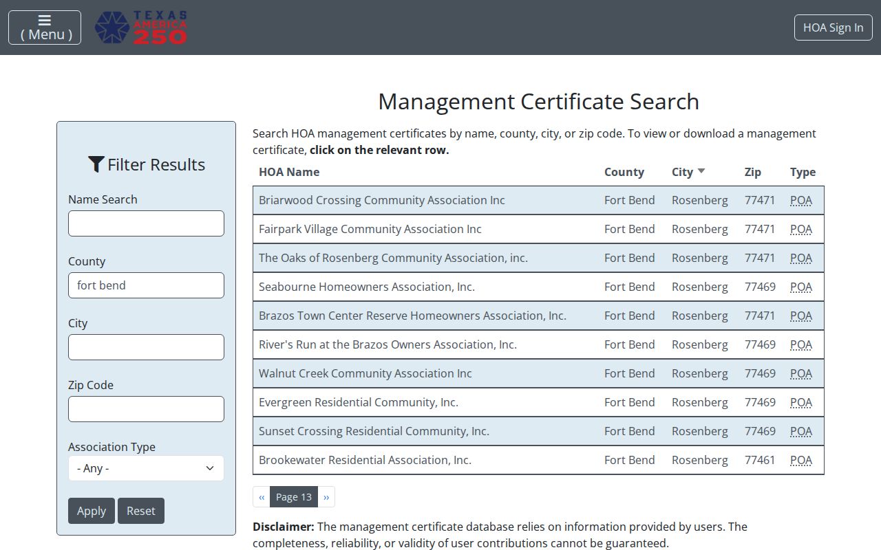
Use a matching postal code as one geographic clue, then compare the certificate date, FBCAD subdivision field, recorded plat, and City mapping before describing an area.
Rosenberg ZIP Terms
Postal terms help describe an address, but none of them identifies who receives mail there. Keeping those terms distinct makes it easier to avoid overreading a postal-directory result.
- ZIP code
- A USPS delivery-area code. In Rosenberg, the City identifies 77471 and 77469 within its jurisdiction while acknowledging that it does not control the codes.
- ZIP+4
- An added delivery-sequencing segment used with a ZIP code. It refines mail routing and does not create a municipal boundary.
- PO-box ZIP
- A ZIP used for post-office boxes. Research did not identify a Rosenberg PO-box-only ZIP, so no such local claim is made here.
- Unique ZIP
- A ZIP assigned to one organization or destination. Research did not identify a unique Rosenberg ZIP, so an address-level USPS check remains necessary.
- Carrier route
- A mail-delivery grouping within a postal area. It is a routing concept, not proof of property ownership or residence.
Rosenberg ZIP History Clues
Historic address research needs more than a current postal code. The City’s Map Library includes a Richmond Rosenberg Property Map dated 1939, while current map products show city limits, ETJ, annexations, and planning layers. The City history also ties Rosenberg to an 1880 railroad junction and the Brazos-area “Mudtown” setting. Those local facts can explain why an older listing uses a road, depot, crossing, or land description that does not resemble a current postal address.
Build an address bridge with the old number, road name, present form if known, lot or block, subdivision, legal description, directory year, and map source. The research did not locate a complete official Rosenberg street-renumbering chronology. Preserve both address forms until a plat, recorded deed, directory, or City record supports the connection. For historical households, a postal area narrows geography, while the older directory collections and deed trail supply the evidence.
Note: Record the map date and layer name because postal labels, annexations, precincts, and service boundaries do not change on the same schedule.
Rosenberg ZIP Record Limits
A Rosenberg postal-area search cannot show who receives mail, who owns a parcel, who is registered to vote, which school serves an address, or whether a place is inside city limits. USPS says its lookup does not confirm that a person or company is at an address. FBCAD can display appraisal-owner and mailing fields, while a deed records parties to an instrument. Those roles can differ from an occupant and from each other.
For a public-record question, ask the office that holds the defined record family. The Texas Public Information Act is a route to existing government records, not a request for a combined resident file. Protect sensitive addresses and personal identifiers, and do not use location information to track, harass, or harm anyone.